Datasets
The BackPack Dataset
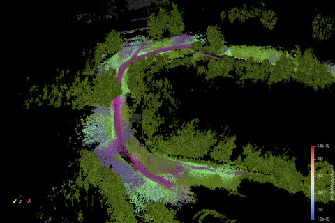
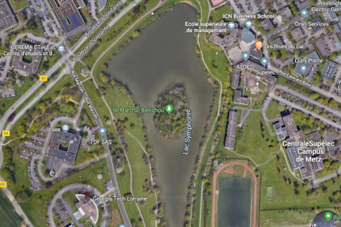
The backpack dataset is a cross-seasonal semantic dataset, captured on a monthly basis between August 2020 and July 2021, around lake Symphony in Metz, France. The data was captured on-foot, by carrying a sensor suite that contains an rs-bPearl lidar, 3 FLIR cameras, a vectornav VN-200 INS and an EMLID RTK GPS. The 1.31 KM trajectory is a combination of mud and bike trails. The same trajectory was taken during the 12 surveys.

The dataset web page is available here.
Symphony Lake Dataset
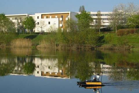
Symphony Lake Dataset consists of 121 visual surveys of a lakeshore over more than three years in Metz, France. Unique from roadway datasets, it adds breadth to a space at a time when larger and more diverse datasets are needed to train data hungry machine learning methods. Over 5 million images from an unmanned surface vehicle capture the unstructured, natural environment as it evolved over time. Significant variation in appearance is present on time scales of weeks, seasons, and years. Success in this space may demonstrate advancements in perception, SLAM, and environment monitoring.
The complete raw surveys can be found on the following links:
- Symphony Lake Dataset 2014
- Symphony Lake Dataset 2015
- Symphony Lake Dataset 2016
- Symphony Lake Dataset 2017
On top of the raw surveys, some pre-processed results are also available:
- Symphony Lake Dataset Visual Benchmark
- Symphony Lake Dataset image pair dataset
- Symphony Lake Dataset 2D localisation and mapping